- What impact will the proposed project have conservation areas?
- Minimized the number of homes impacted by the corridor.
- Avoid close proximity to Schools and Daycares.
- Avoid routes high cost.
The project also required a PowerPoint presentation accompanied with Commentary. Links to both documents are provided below.
Links:
http://students.uwf.edu/joo3/Orunmbe's_Presentation.pptx
http://students.uwf.edu/joo3/Orunmbe's_Commentary.docx
http://students.uwf.edu/joo3/Orunmbe's_Presentation.pptx
http://students.uwf.edu/joo3/Orunmbe's_Commentary.docx
Scroll down to view some of the maps created during the Bobwhite-Manatee Transmission Line project ->
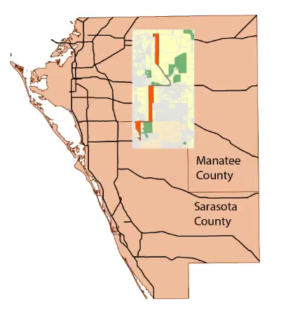 |
| Overview Location of the Study Area, and Preferred Corridor in Manatee and Sarasota Counties. |
 |
| Map show the End-to-end straight line distance and Center point distance. |
 |
| Map showing Conservation Areas. |
 |
| Map shows home that are directly within the buffer. |
 |
| Map shows Preferred Corridor proximity to Schools. |
No comments:
Post a Comment